
Antenne Région Valais romand
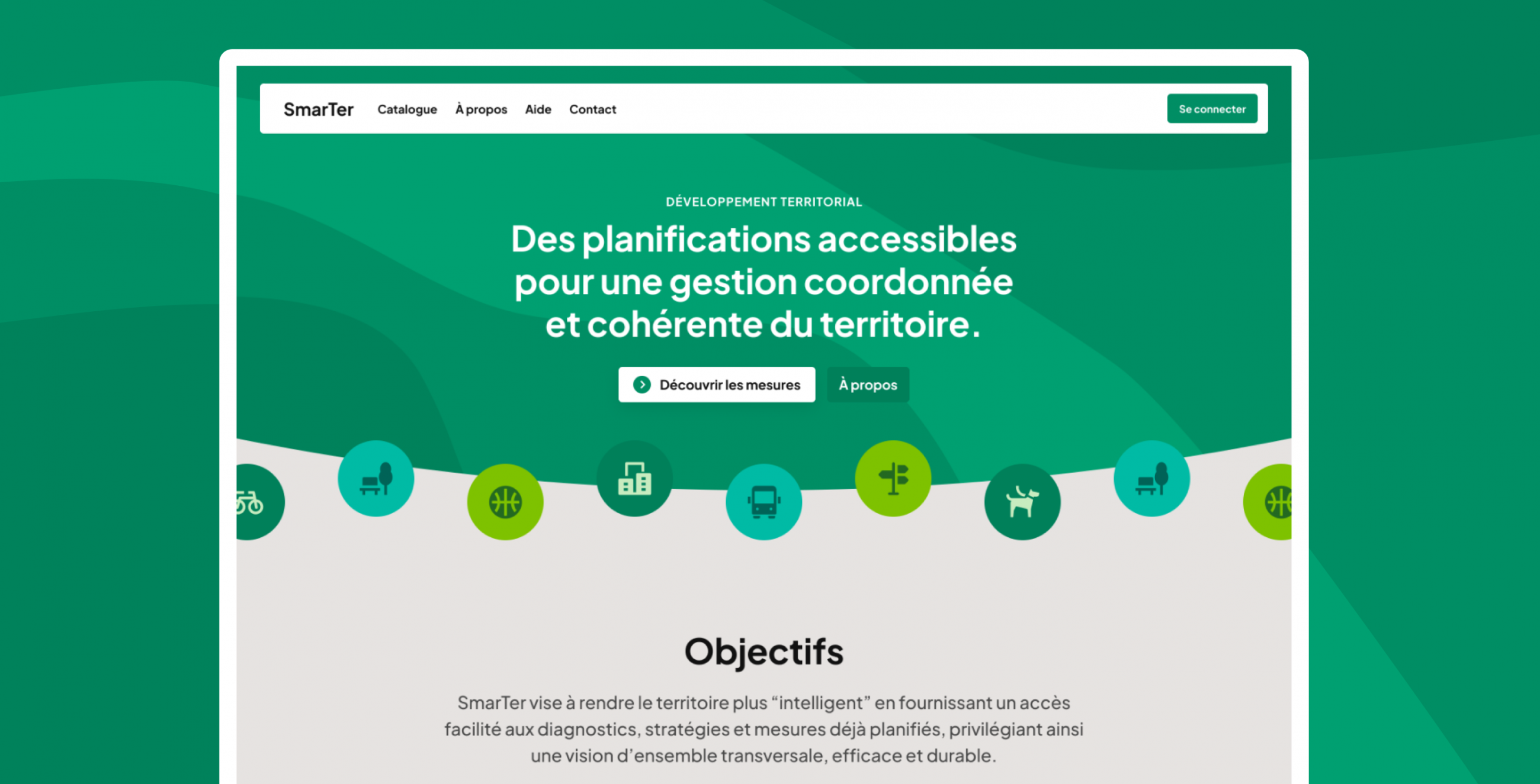
SmarTer Application - Accessible Planning for Coordinated and Consistent Land Management
The Antenne Région Valais romand (ARVr) commissioned us, in collaboration with the company MicroGIS, to create a digital interface that consolidates and provides access to all information related to agglomeration projects, intermunicipal master plans, and the territory of Valais Romand.
smarter-plan.chDesign
- Information architecture
- User research
- Visual design
Project management
- General communication
- Prioritization and planning
Design
- Information architecture
- User research
- Visual design
Project management
- General communication
- Prioritization and planning
Mandate
Organizing and evolving a territory are complex tasks and must be supported by high-quality tools that provide a long-term perspective."
This web application should be accessible to elected officials, professionals in the field, as well as citizens interested in the development of the territory in their municipality.
Challenges Encountered
A Bit of Vocabulary
Although the concepts of territories were not entirely unfamiliar to us, we had to immerse ourselves in the specific vocabulary of land planning. For this, we had the support of the company MicroGIS."
Some definitions we encountered:
- Land Planning: The strategic implementation of a political vision for the medium/long term of a territory through development projects.
- Agglomeration Project: A planning instrument aimed at improving and coordinating the development of transportation and urbanization within an agglomeration. Each project can be updated every 4 years and is reevaluated by the Confederation, which decides on funding allocations.
- Intermunicipal Master Plan: A land planning tool that ensures coherence between a strategic vision across several municipalities and the implementation of activities affecting the organization of the territory.
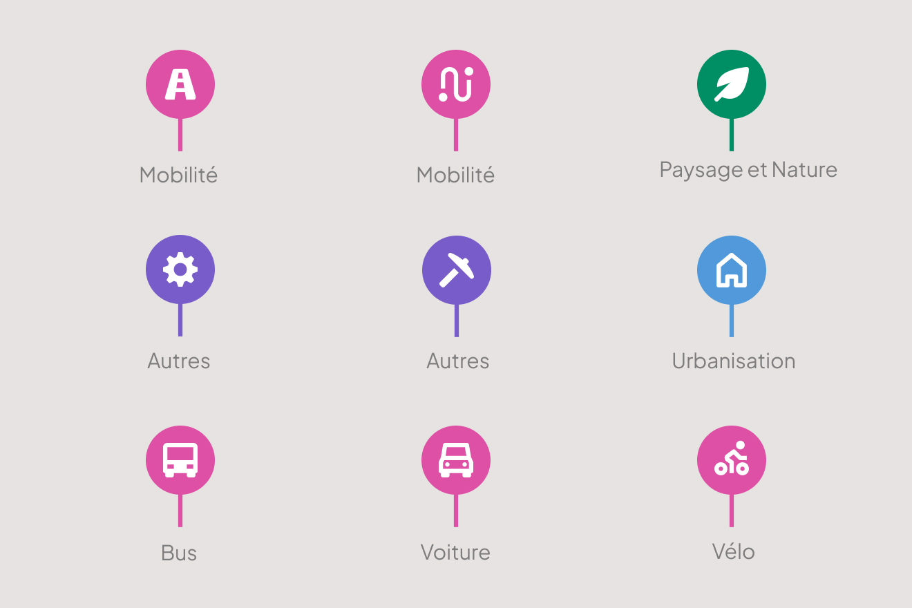
- Measure: The realization of an objective or development project within the framework of planning. Examples: requalification of village crossings, pedestrian bridge, soft mobility pathways, bus stops, road bridge, landscaping, etc.

An Interface for Multiple Profiles
Through a personas workshop, we were able to identify the different needs of the target audiences. Indeed, a municipal president has different objectives than a technician or a citizen. Here are a few examples:
- "Technician, Professional: Follow various land studies and liaise with the municipality, and should also be able to access up-to-date documents.
- Politician (Municipality): Review ongoing files in preparation for decision-making within their municipal mandate and access information in the most efficient and straightforward manner.
- Legislator: Obtain information on topics concerning their municipality.
- Site Administrator: Ensure the quality of data on the interface and the proper functioning of the platform.
- Citizen: See everything that is happening around their area.
The Art of Division
This project generated a great deal of enthusiasm and ideas were plentiful. We worked closely with ARVr to define priorities and break down the various functionalities to release an initial usable version.
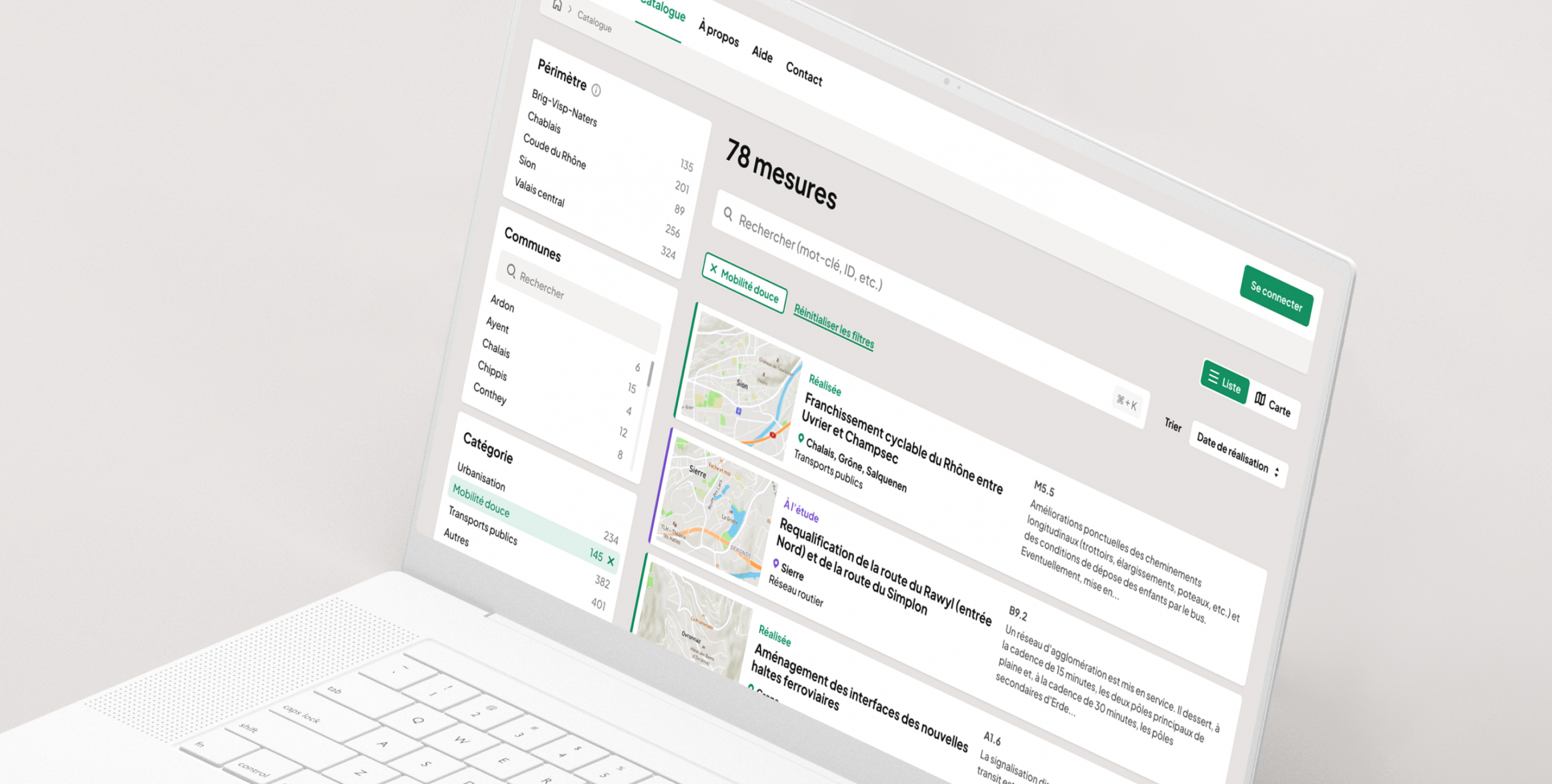
Our first goal was to replace the binders in which each agglomeration stores its measures, with a digital solution that allows for searching, filtering, and easier updating.
The next step is to aid decision-making through our interface. The aim is to make data such as planning and budgeting of measures accessible to the municipalities.
Key Features
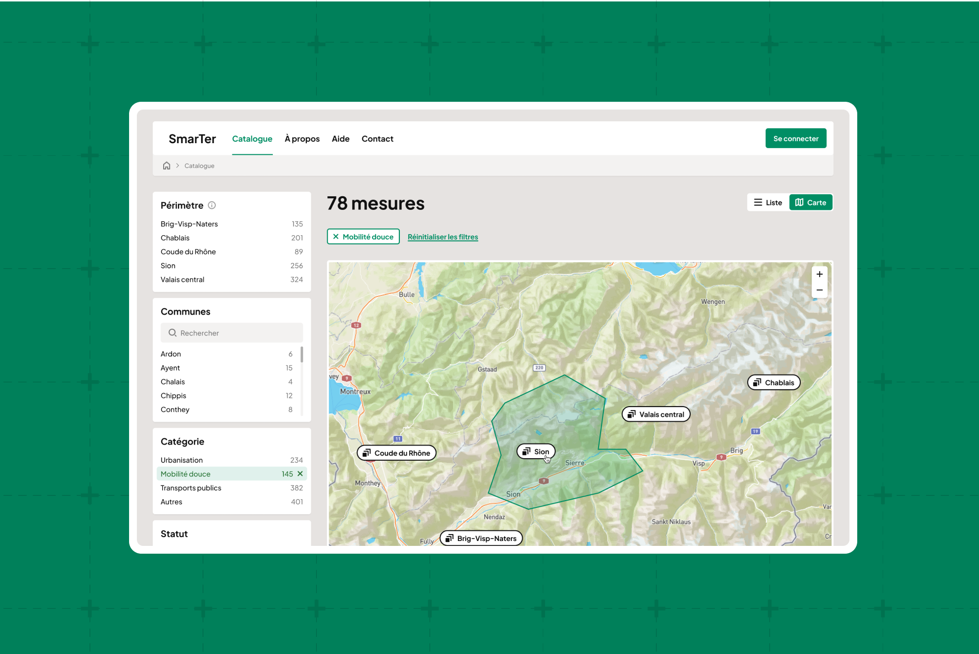
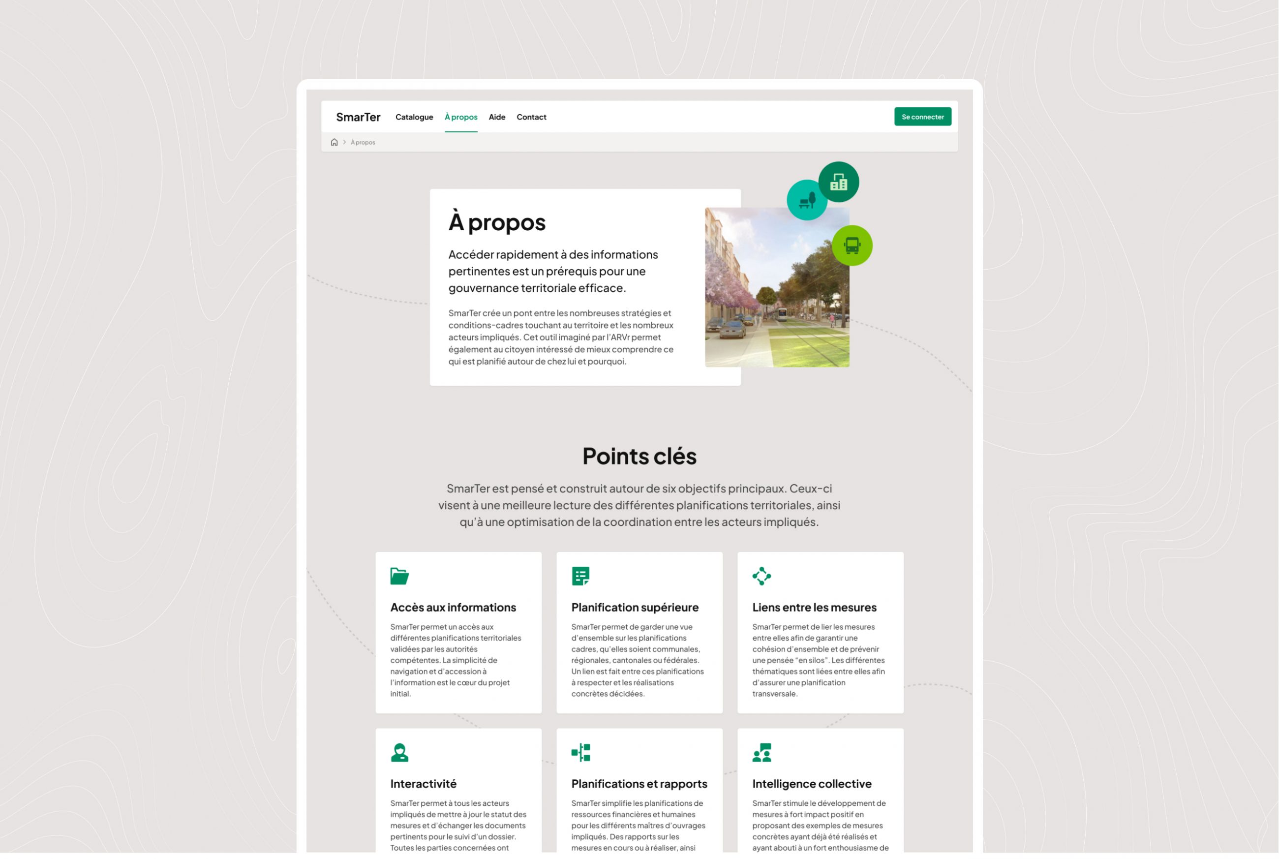
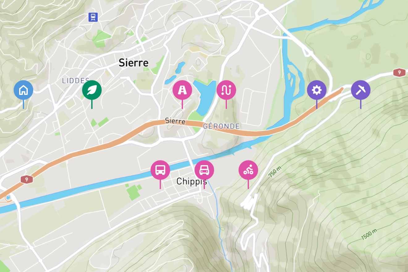
View Measures
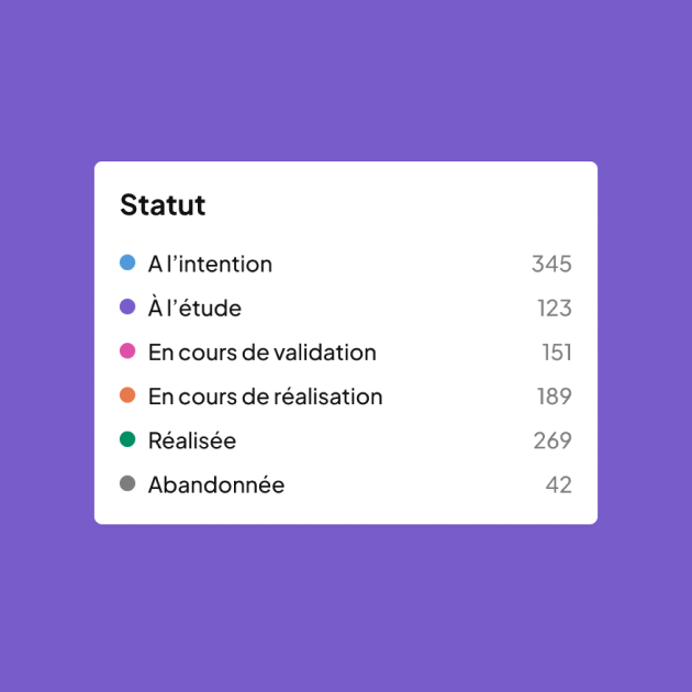
The main goal of this interface is to list measures. It is also possible to display their locations on a map, filter them by theme (urbanization, mobility, environment), and by status (are they already planned? or even completed?).
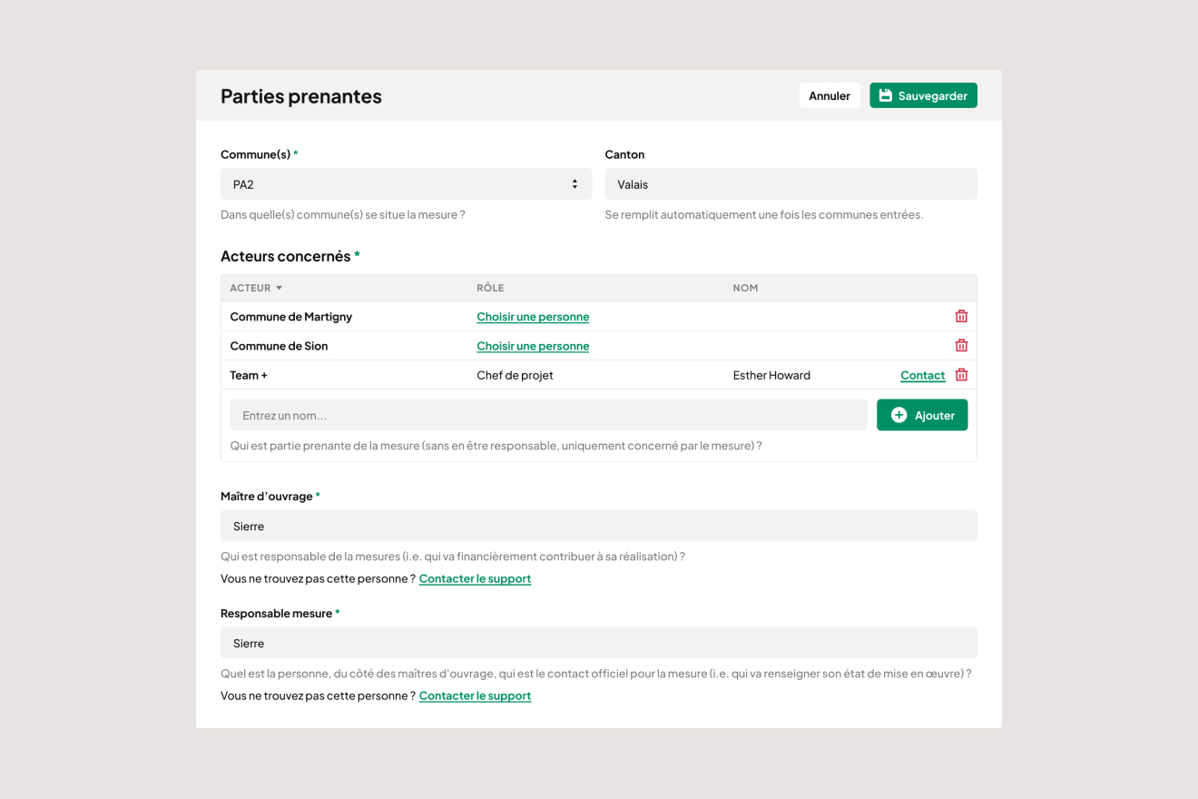
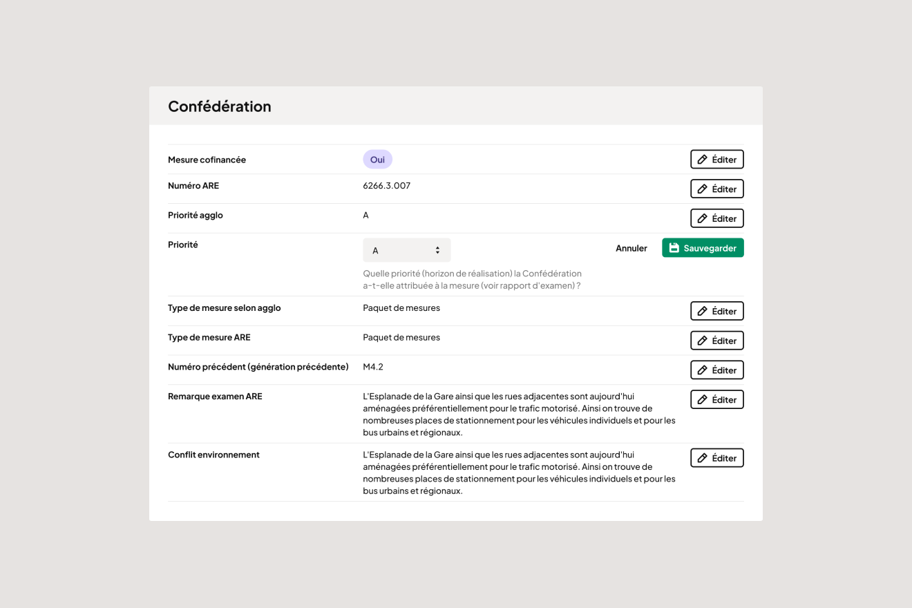
Detailed information can then be obtained about each measure, depending on its status and the rights you have regarding it (does this measure belong to my municipality?). You can learn more about what is planned, the stakeholders involved, and its budget, including what is funded by the Confederation, for example.
Document Measures
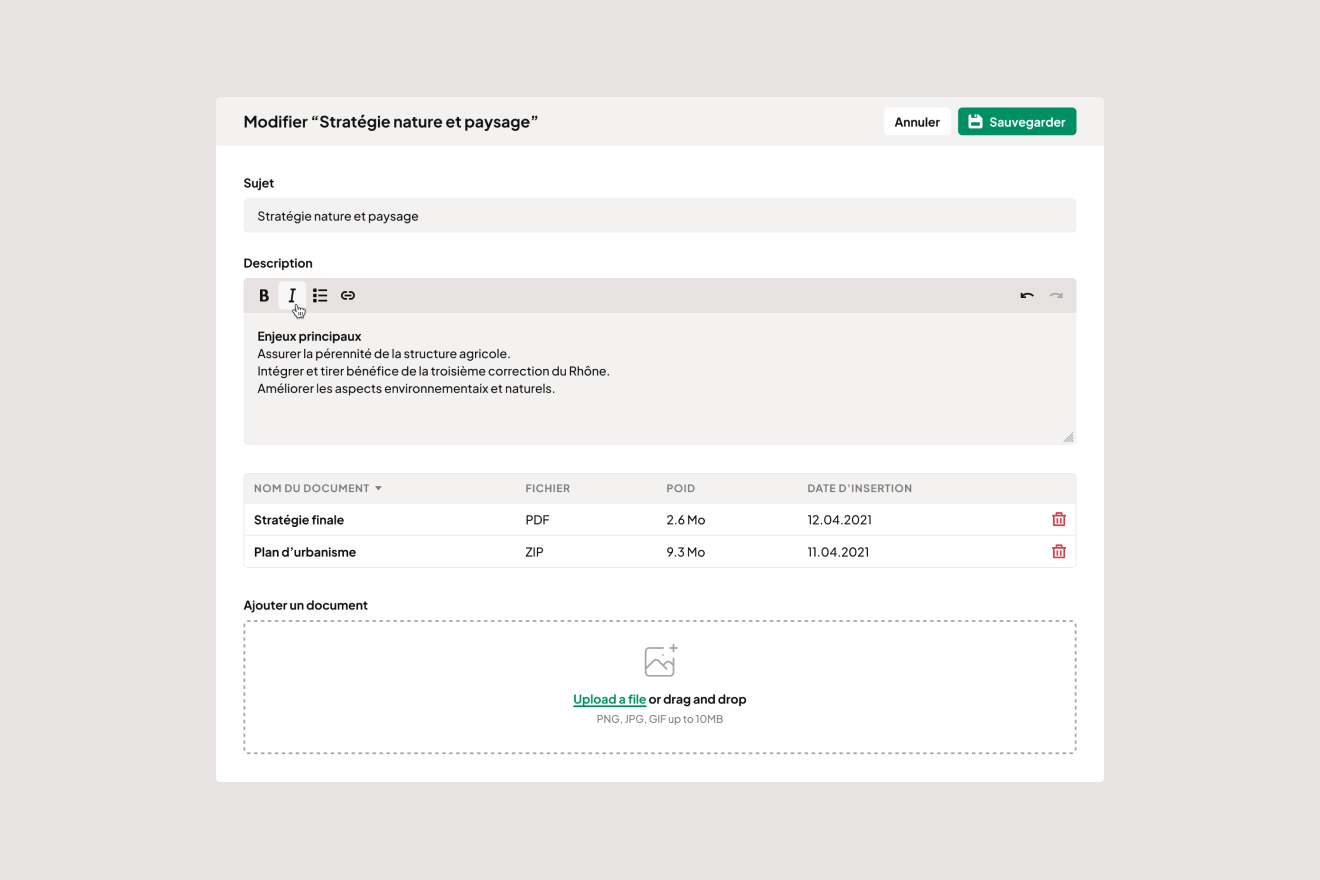
Measures are living projects; they evolve. Technicians need to be able to update not only their status but also add various details about them.
To achieve this, we created an interface that allows editing the measure within its context, according to the user's permissions.
For more complex data, such as role assignments, an advanced administration area is provided.
Access a Dashboard
To provide an overall view of the situation and forecasts, dashboards by agglomeration, as well as by scope, have been implemented. These dashboards aggregate statistical data and offer a summary of ongoing measures by territory.
Solutions/Technical Challenges
The Model
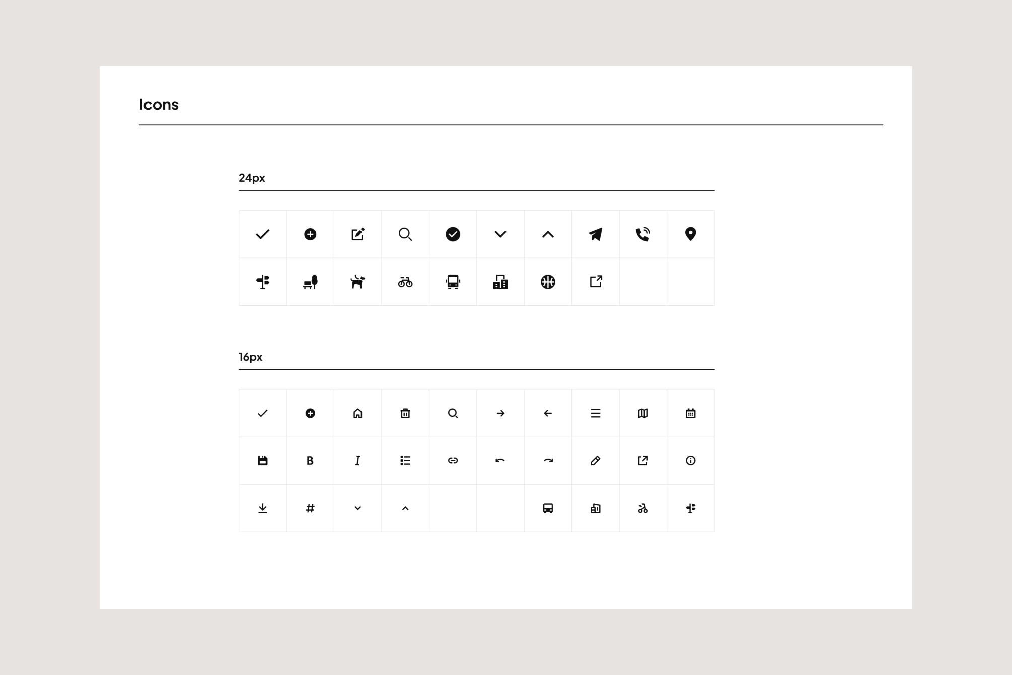
The first challenge was modeling. A measure involves a complex set of fields of various types (simple data, rich data, geographic data, media, relational and/or multi-relational, etc.), and each of these fields can be accessed and edited according to specific access levels and in alignment with the current user's role. Therefore, it was necessary to consider both the relevance and sustainability of the model in light of future developments of the project.
Viewing and Editing
Then, for greater flexibility, we opted for a decoupled approach. PHP Symfony supported by API Platform on the backend and Next.js for the client application. The concept is as follows: the user logs in (or not) to the client application and receives a token. They then make requests to the server application to retrieve raw data from the platform (list and search of measures, details of information, etc.), and based on their token, they can only view and edit the information they have access to. The major challenge was to implement modular viewing and editing interfaces where each field and group of fields can be absent. Editing a measure does not involve a large form, but rather a multitude of small forms that can be submitted in parallel.
Mapping
As a primarily geographical representation application, it was also essential to set up interactive maps that allow users to navigate and find measures. With the support of MicroGIS and the experience of our developers in these technologies, we implemented a WebGL vector-based geographical visualization with features tailored to the project's needs (clusters, spiderification, data layers, etc.). In addition to visualization, another challenge was managing, storing, and displaying complex geographical data. For this, we relied on the GeoJSON standard, a very accessible and widely used format in web mapping.
Conclusion
This project is continuously evolving, and new needs are emerging as it is used. Here are some potential future directions:
- Implementing examples and best practices to promote collaboration and collective intelligence
- Usage by municipalities for their measure management
- Expansion to other territories
This project has been full of challenges and has taught us a great deal: both about the topic of land planning and from a technological perspective. Our interactions have been enriching, whether directly with clients, with municipalities, or with MicroGIS, our project partners.
We look forward to seeing it continue to evolve and be used by more people.
Témoignage
“ Starting from a complex set of requirements, Antistatique demonstrated great enthusiasm and professionalism from the very beginning to execute this project with significant territorial impact. A new and highly interdisciplinary topic was quickly mastered to adapt to our needs, paving the way for a dynamic, evolving project that has already received very positive feedback from the field. ”Léonard Evéquoz
Deputy Director